Where Lower Dolpo sits in Nepal’s trekking geography
Lower Dolpo lies in the trans-Himalayan belt of western Nepal, north of the main Himalayan rainfall zone and south of the Tibetan Plateau. This positioning places the region in a rain-shadow environment where dry alpine basins, sparse vegetation, and high wind exposure dominate much of the trekking experience.
Unlike loop-style trekking regions such as Annapurna, Lower Dolpo functions as a corridor system. Trekkers typically approach via Dunai after flying into Juphal, then move gradually north into higher valleys before crossing major passes. This geography explains why products such as Lower Dolpo Trek require extended durations and conservative pacing.
Terrain progression: from river gorges to high passes
The physical character of Lower Dolpo changes dramatically over the course of the trek. Early stages follow river gorges with narrow trails, warmer temperatures, and occasional exposure. As elevation increases, the landscape opens into wide alpine basins where wind becomes a defining factor.
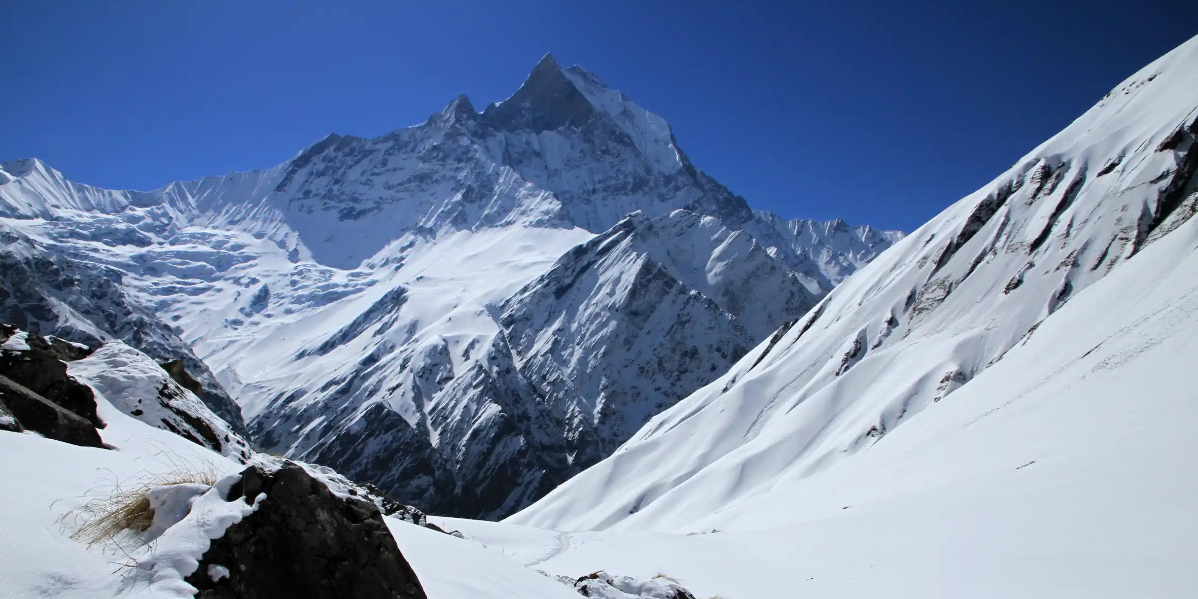
Above these basins lie the region’s defining features: high mountain passes such as Numa La and Baga La. These passes are not technical climbs, but they demand endurance, acclimatization, and stable weather windows. Traverses such as the Dhorpatan to Lower Dolpo Traverse amplify this terrain progression by combining two distinct ecological zones.
Altitude reality: understanding where the risk truly lies
Lower Dolpo is often misrepresented as an “extreme altitude” trek based solely on pass elevations. In reality, most overnight camps remain below 4,500 meters. The challenge lies in short but intense exposure during pass days, when trekkers briefly ascend well above 5,000 meters.
This distinction between highest point and highest sleeping altitude is critical. Many feasibility failures occur when itineraries compress after flight delays and push trekkers too quickly toward pass crossings. This risk is examined in detail in Is Lower Dolpo Trek Feasible?, which explains why buffer days are non-negotiable in this region.
Cultural identity: Tarap Valley and Bon heritage
Lower Dolpo’s cultural landscape is rooted in Tibetan Buddhism and Bon traditions, particularly in settlements such as Dho Tarap. Mani walls, chortens, and monasteries are integral to daily life rather than decorative features for visitors.
Trekkers entering these valleys step into living cultural systems shaped by isolation and altitude. Understanding this context is essential for respectful travel and is further expanded in our comparative study Karnali Himalaya Remote Trekking Regions.
Logistics and accommodation reality
Lower Dolpo is not a lodge-based trekking region. While a few basic lodges exist near access corridors, the majority of itineraries rely on fully supported camping. Food, fuel, water treatment, and waste management must be planned in advance.
This expedition-style model is one of the primary reasons Lower Dolpo remains unsuitable for first-time trekkers. Those unfamiliar with camping at altitude often underestimate the cumulative fatigue involved.
Understanding these logistical constraints helps trekkers set realistic expectations and reduces conflict between perceived comfort and actual conditions.
Seasonality and access constraints
Although Lower Dolpo lies in a rain-shadow zone, monsoon season still presents serious challenges due to flight disruption and access corridor instability. The most reliable trekking windows remain spring (April–May) and autumn (October–November).
Flights between Nepalgunj and Juphal are the primary access bottleneck. Delays are common and must be treated as normal operational conditions rather than exceptions.